.jpg)
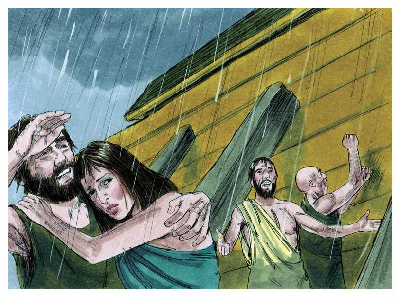
When the movie “Noah” came out in 2014 there was a lot of hype and controversy. Critics questioned the plotline for not following the Biblical account. In the Islamic world several countries banned the movie since it visually depicted a prophet, strictly forbidden in Islam. But these issues are minor when compared to a much deeper and longer-running controversy.
Did such a worldwide flood really happen? That’s a question worth asking.
Multiple cultures all around the world retain legends of a great flood in their past. No comparable myths of other disasters like earthquakes, volcanoes, wildfires or plagues exist across so many widely distributed cultures like these flood accounts. So anthropological evidence for memories of a past global flood exists. But do any physical evidences exist today that point to Noah’s flood having happened in the past?
The Power of Moving Flood Water seen in Tsunamis
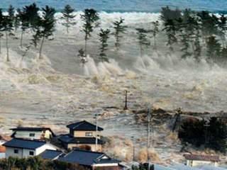
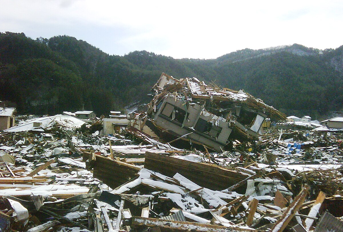
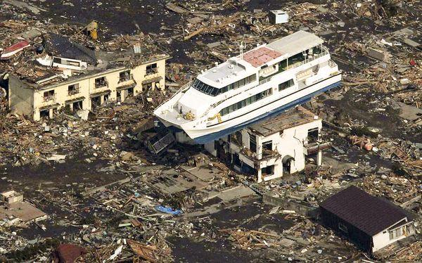
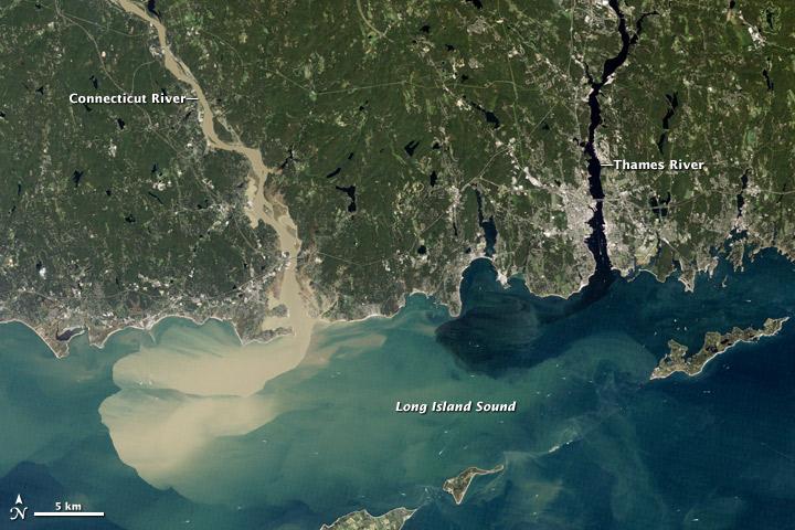
Let’s start by surmising what such a flood, if it happened, would have done to the earth. Certainly, a flood like that would involve unimaginable quantities of water moving at great speeds and depths over continental distances. Large quantities of water moving at high speeds have a lot of kinetic energy (KE=½*mass*velocity2). This is why floods are so destructive. Consider pictures of the 2011 Tsunami that devastated Japan. There we saw the extensive damage that kinetic water energy caused. The tsunami easily picked up and carried large objects like cars, homes and boats. It even crippled nuclear reactors in its path.
Sediments and Sedimentary Rock
Thus, when water’s speed increases it will pick up and transport larger and larger sediment. Particles of dirt, then sand, then rocks and even boulders are carried along as water velocity increases.
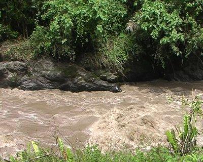
This is why swollen and flooding rivers are brown. They are loaded with sediment (soil and rock) picked up from the surfaces over which the water has traveled.
When water starts to slow down and loses its kinetic energy it then drops this sediment. This deposits in laminar layers, looking like layers of pancakes, resulting in a particular kind of rock – sedimentary rock.
Sedimentary Rock formed in History
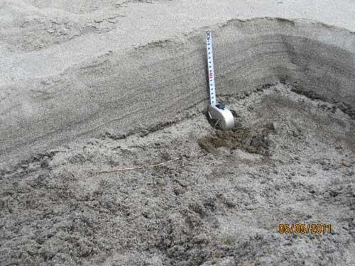
You can easily recognize sedimentary rock by its trademark pancake-like layers stacked upon one another. The figure below shows sedimentary layers about 20 cm thick (from the measuring tape) deposited during the devastating 2011 tsunami in Japan.
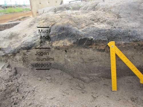
Tsunamis and river floods leave their signatures behind in these sedimentary rocks long after the flood has receded and things have turned back to normal.
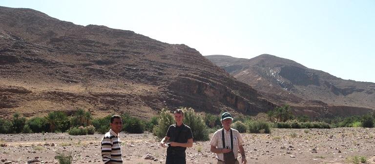
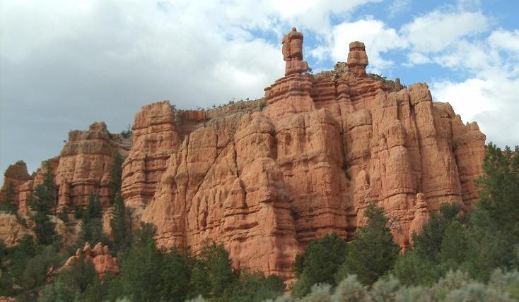
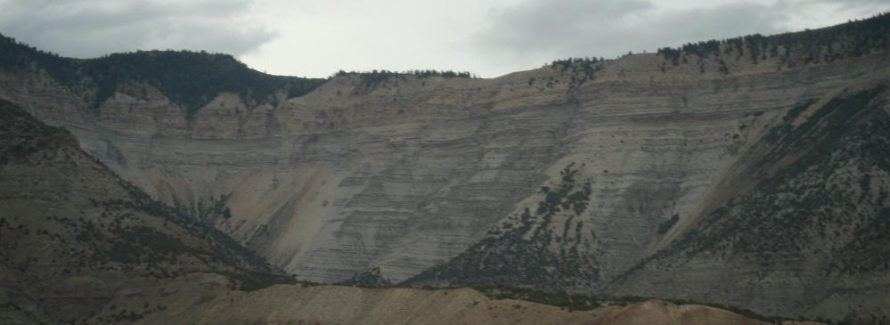
So, do we find sedimentary rocks that are, similarly, signature markers for a global flood that the Bible claims happened? When you ask that question and look around you will see that sedimentary rock literally covers our planet. You can notice this type of pancake-layer rock on highway cut-a-ways. The difference with this sedimentary rock, compared with the layers produced by the tsunamis of Japan, is the sheer size. Both laterally across the earth and in vertical thickness of sedimentary layers they dwarf the tsunami sediment layers. Consider some photos taken of sedimentary rocks where I have traveled.
Sedimentary Strata around the World
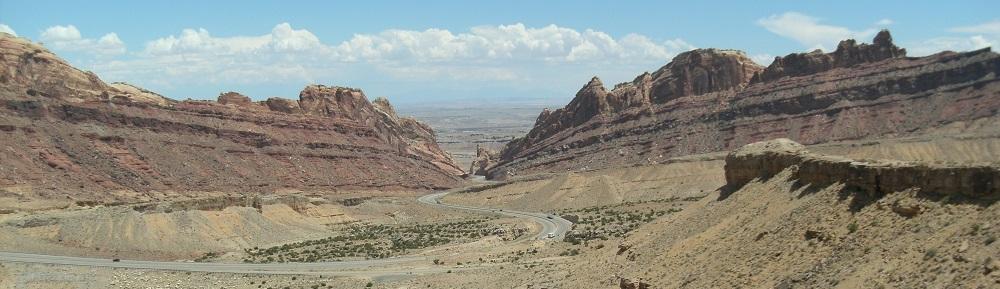
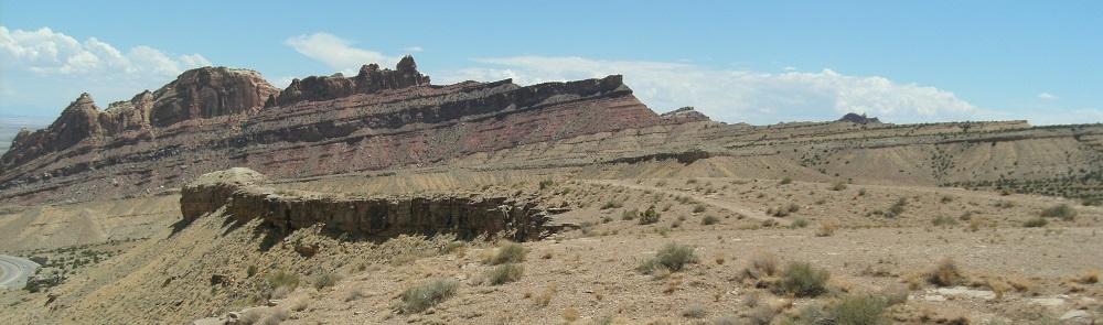
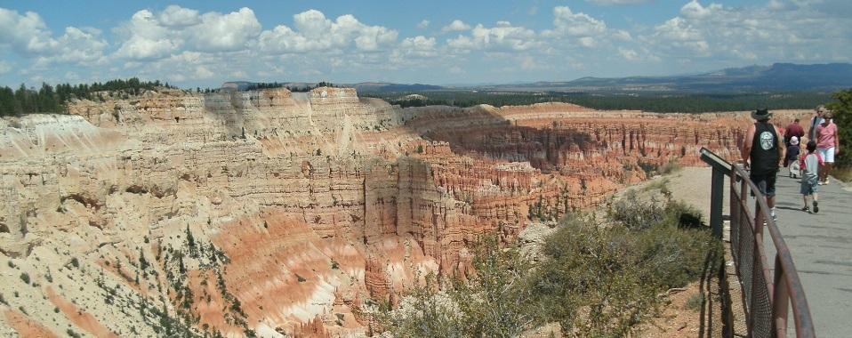
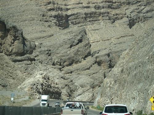
So, one tsunami caused devastation in Japan but left sedimentary layers measured in centimeters and extend inland a few kilometers. Then what caused the gigantic and continent-wide sedimentary formations found almost over the entire globe (including on the ocean bottom)? These measure vertically in hundreds of meters and laterally in thousands of kilometers. Moving water made these immense strata at some point in the past. Could these sedimentary rocks be the signature of Noah’s flood?
Rapid Deposition of Sedimentary Formations
No one argues that sedimentary rock of unbelievably massive scope covers the planet. The question centers on whether one event, Noah’s flood, laid down most of these sedimentary rocks. Alternatively, did a series of smaller events (like the 2011 tsunami in Japan), build them up over time? The figure below illustrates this other concept.
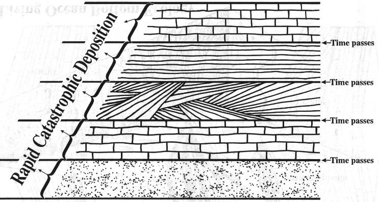
In this model of sedimentary formation (called neo-catastrophism), large intervals of time separate a series of high-impact sedimentary events. These events add sedimentary layers to the previous layers. So, over time, these events build the huge formations that we see around the world today.
Soil Formation and Sedimentary Strata
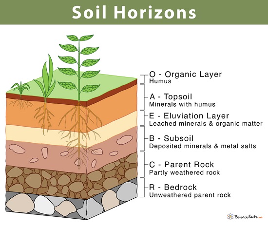
Do we have any real-world data that can help us evaluate between these two models? It is not that hard to spot. On top of many of these sedimentary formations, we can see that soil layers have formed. Thus, soil formation is a physical and observable indicator of time’s passage after sedimentary deposit. Soil forms into layers called horizons (A horizon – often dark with organic material, the B horizon – with more minerals, etc.).
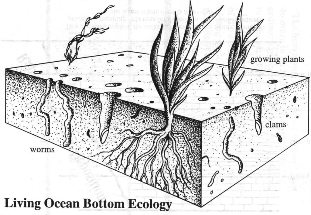
Seafloor Bioturbation and Sedimentary Rocks
Ocean life will also mark sedimentary strata forming ocean floors with signs of their activity. Wormholes, clam tunnels, and other signs of life (known as bioturbation) provide tell-tale signs of life. Since it takes some time for bioturbation, its presence shows the passage of time since the laying down of the strata.
Soils and Bioturbation? What do the Rocks say?
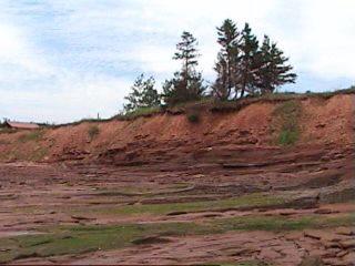
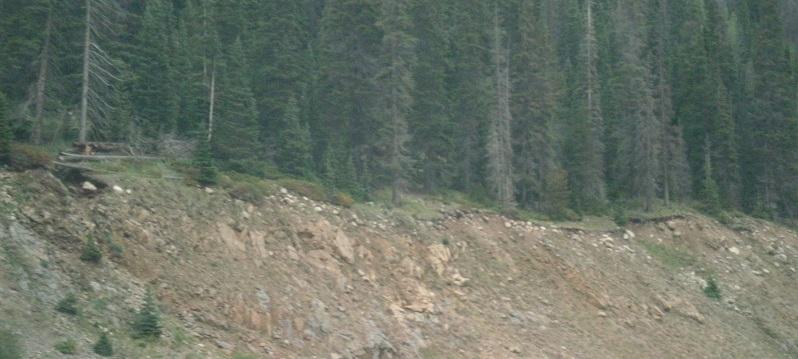
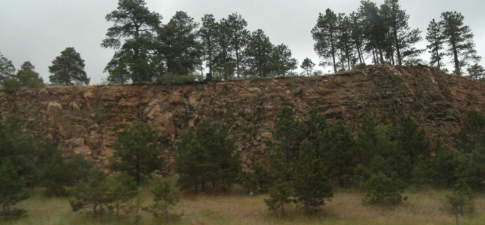
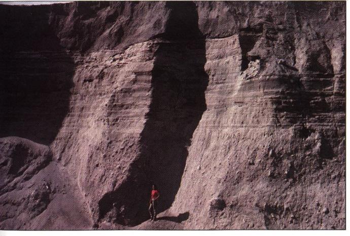
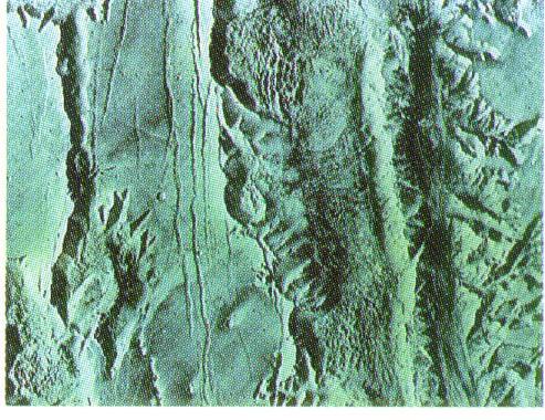
Armed with these insights we can search for evidence of soil formation or bioturbation at these ‘Time passes’ strata boundaries. After all, neo-catastrophism says that these boundaries had been exposed on land or underwater for significant periods. In that case, we should expect some of these surfaces to have developed soil or bioturbation indicators. When subsequent floods buried these time boundary surfaces the soil or bioturbation would also have been buried. Take a look at the photos above and below. Do you see any evidence of either soil formation or bioturbation in the layers?
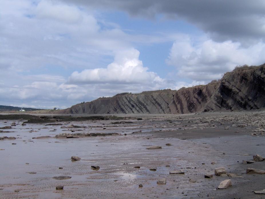
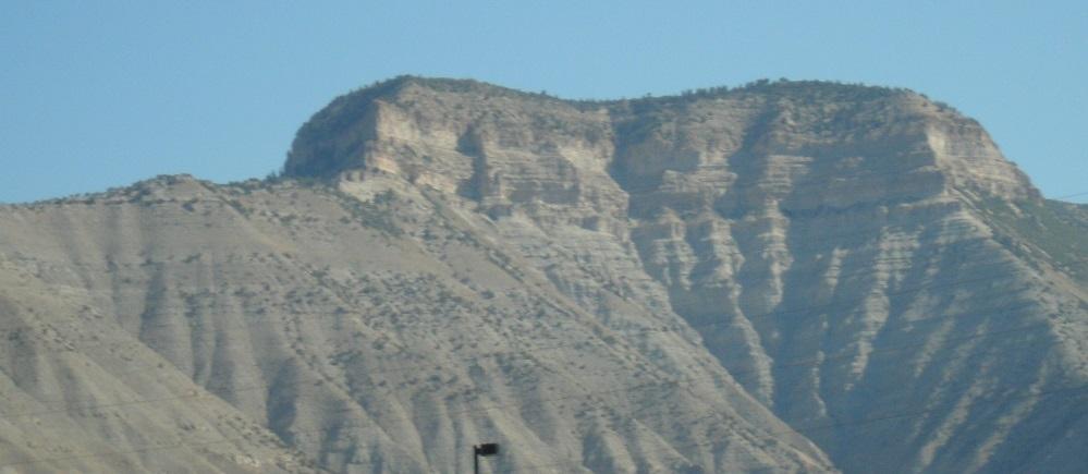
There is no evidence of soil layers or bioturbation in the above photo or the one below. Observe the Hamilton escarpment photo and you will see no evidence of any bioturbation or soil formation within the layers. We see soil formations only on the top surfaces indicating time passage only after the last layer was deposited. From the absence of any time indicators like soil or bioturbation within the strata layers it appears that the bottom layers formed almost at the same time as the top. Yet these formations all extend vertically up about 50-100 meters.
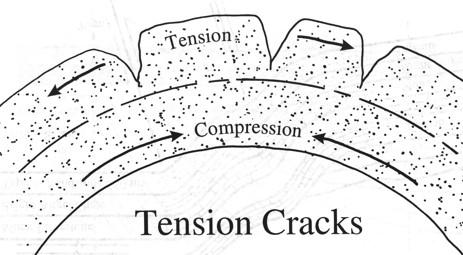
Brittle or Pliable: Folding of Sedimentary Rocks
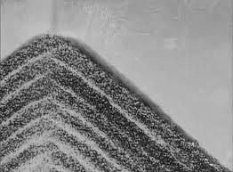
Water permeates sedimentary rock when it initially deposits sedimentary strata. Thus, freshly laid sedimentary strata bend very easily. They are pliable. But it only takes a few years for these sedimentary strata to dry out and harden. When that happens the sedimentary rock becomes brittle. Scientists learned this from the events of Mount St Helens eruption in 1980 followed by a 1983 lake breach. It took only three years for those sedimentary rocks to become brittle.
Brittle rock snaps under bending stress. This diagram shows the principle.
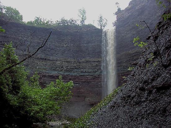
The Brittle Niagara Escarpment
We can see this sort of rock failure in the Niagara escarpment. After these sediments were laid down they became brittle. When an upthrust later on pushed up some of these sedimentary layers they snapped under the shear stress. This formed the Niagara escarpment which runs for hundreds of miles.
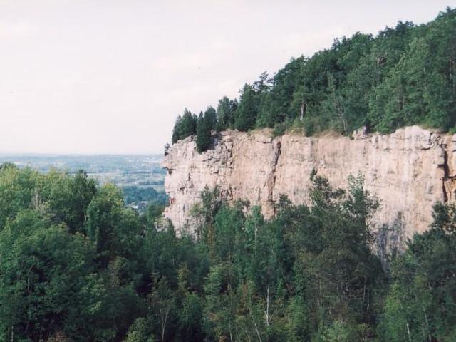
Therefore we know that the upthrust which produced the Niagara escarpment happened after these sedimentary strata became brittle. There was at least enough time between these events for the strata to harden and become brittle. This does not take eons of time, but does take a couple of years as Mount St. Helens showed.
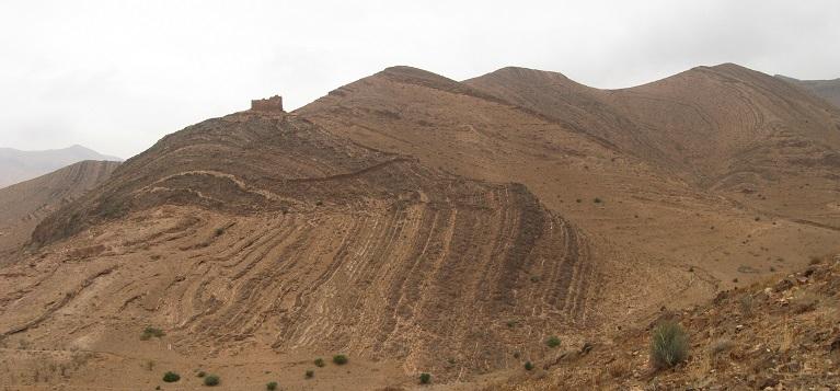
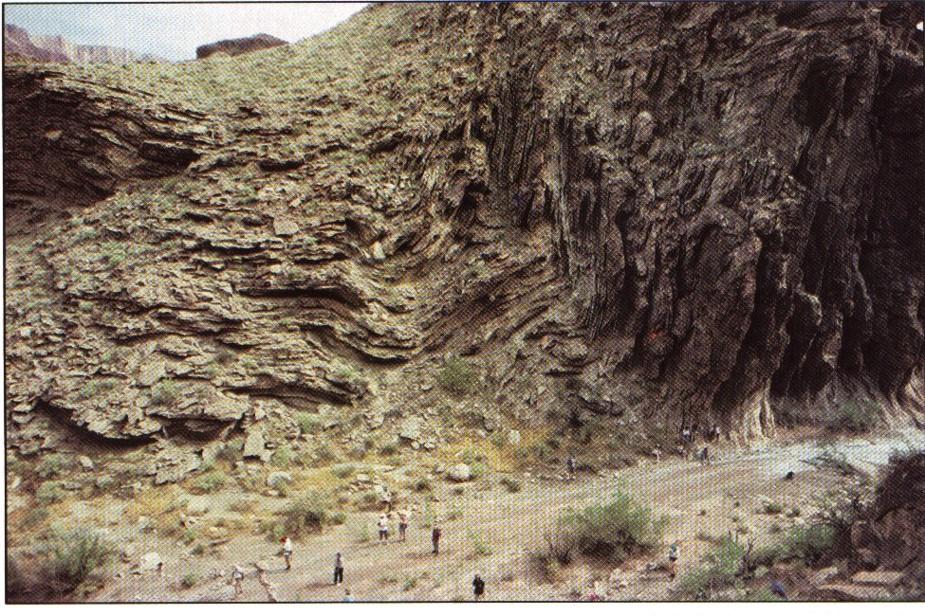
Pliable Sedimentary Formations in Morocco
The photo below shows large sedimentary formations photographed in Morocco. You can see how the strata formation bends as a unit. There is no evidence of the strata snapping either in tension (pulled apart) or in shear (sidewise rupture). Therefore this whole vertical formation must have been still pliable when bent. But it takes only a couple of years for sedimentary rock to become brittle. This means that there can be no significant time interval between the formation’s lower layers and its top layers. If there had been a ‘time passage’ interval between these layers then the earlier layers would have become brittle. Then they would have fractured and snapped rather than bent when the formation contorted.
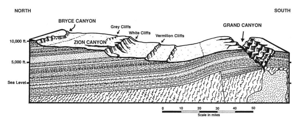
Grand Canyon’s Pliable Formations
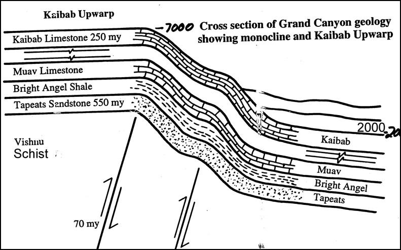
We can see the same type of bending in the Grand Canyon. Sometime in the past, an upthrust (known as a monocline) occurred, similar to what happened to the Niagara Escarpment. This raised one side of the formation one mile, or 1.6 km, vertically up. You can see this from the 7000 feet elevation compared to 2000 feet on the other side of the upthrust. (This gives a difference in elevation of 5000 feet, which in metric units is 1.5 km). But this strata did not snap as the Niagara escarpment did. Instead, it bent at both the bottom and the top of the formation. This indicates that it was still pliable throughout the entire formation. Not enough time had elapsed between the bottom and top layer depositions for the bottom layers to become brittle.
Thus the time interval from the bottom to the top of these layers has a maximum of a few years. (The time it takes for sedimentary strata to become hard and brittle).
So there is not enough time between the bottom layers and the top ones for a series of flooding events. These gigantic layers of rock were laid down – across an area of thousands of square kilometers – in one deposition. The rocks give evidence of Noah’s flood.
Noah’s Flood vs. Flood on Mars
The idea of Noah’s flood having actually happened is unconventional and will take some reflecting.
But at the very least, it is instructive to consider an irony of our modern day. The planet Mars exhibits channeling and evidence of sedimentation. Therefore scientists postulate that Mars was once inundated by a huge flood.
The big problem with this theory is that no one has ever discovered any water on the Red Planet. But water covers 2/3 of the Earth’s surface. The Earth contains enough water to cover a smoothed and rounded globe to a depth of 1.5 km. Continental sized sedimentary formations that appear to have been deposited rapidly in a devastating cataclysm cover the earth. Yet many consider it heresy to postulate that a flood like this has ever occurred on this planet. But for Mars we actively consider it. Is that not a double standard?
We may look at the Noah movie as only a re-enactment of a myth written as a Hollywood script. But perhaps we should reconsider whether the rocks themselves aren’t crying out about this deluge written on scripts of stone.